Site Instructions
Glossary
Go to Glossary
Historical Maps
Primary Regions of Israel/Palestine
Primary Sites Examined in the Course
Ancient Near Eastern Maps
Jerusalem in Old Maps and Views. Kind of a clunky interface, but you can look at maps of Jerusalem from the 6th-19th centuries. For a better interface see this link
Osher Map Library at the Smith left for Cartographic Education at the University of Southern Maine. Requires you to search – click on View/Find Maps.
Some Maps of the Roman Empire. Maps are cataloged by region and by place name.
Historical Maps of the Middle East at the Perry-Castaneda Library Map Collection (University of Texas).
Maps of War: Imperial History of the Middle East. 5,000 years of history in 90 seconds.
Some great satellite maps of Israel/Palestine. Note the drop-down menu at the top of the page. Note also the Place Names Index at the top of the page.
A handful of .pdf maps of the Mediterranean.
Index of Cartographic Images illustrating maps from the Ancient Period: 6,200 B.C. to 400 A.D.
Maps of Historic Cities from the Department of Cartography at the Hebrew University of Jerusalem.
Free high resolution Bible study maps. A somewhat difficult website to navigate, but some helpful gems if you’re willing to put in the time.
Bible maps.
Modern Maps
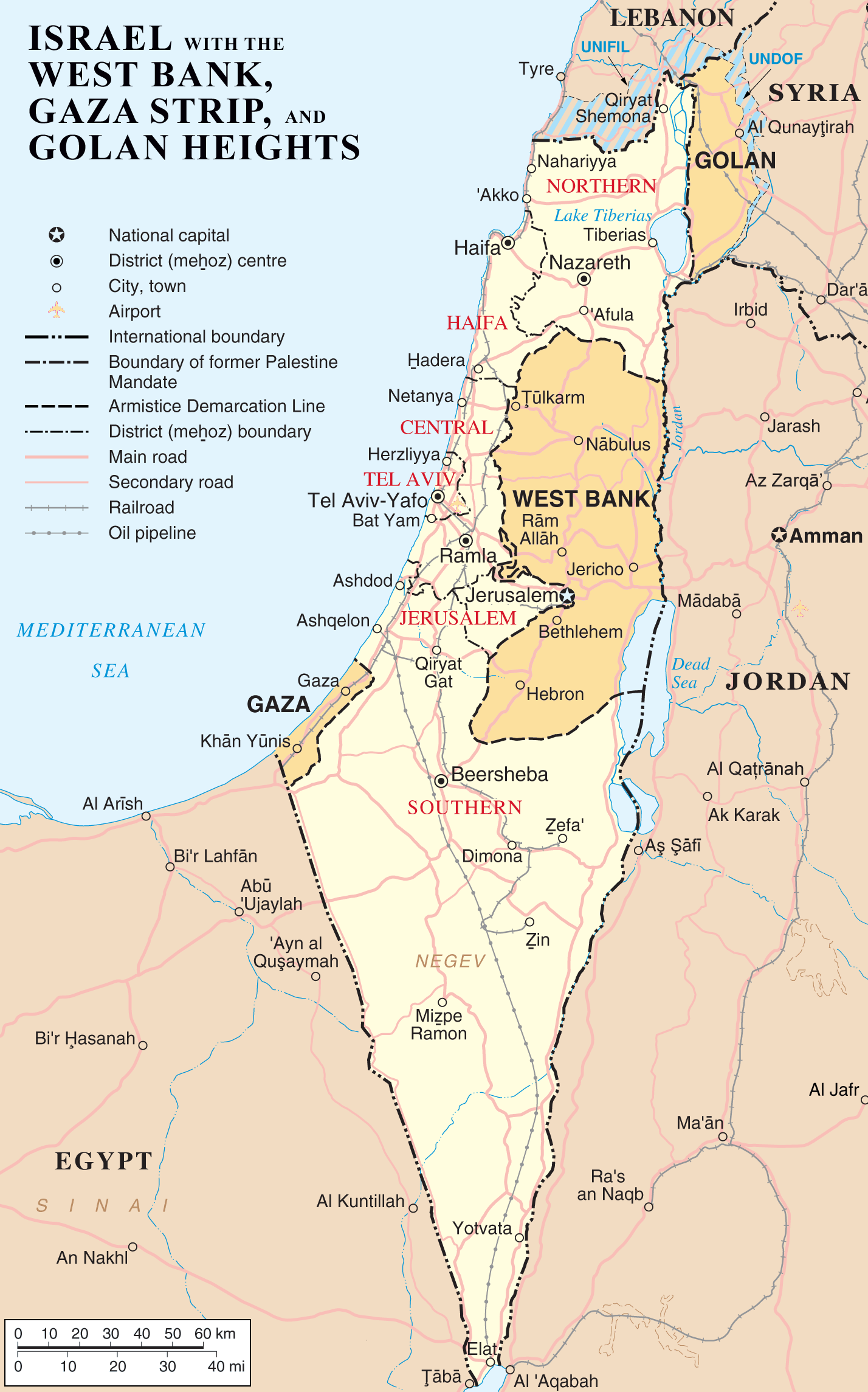
Israel/Palestine
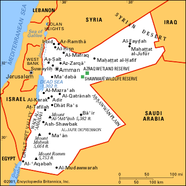
Jordan
Syria
Lebanon
Saudi Arabia
Turkey
Egypt
Iraq
Timelines
Maps of War: Imperial History of the Middle East. (MUST SEE!) 5,000 years of history in 90 seconds.
Biblical History
Timeline of Jerusalem
World Timeline
The Near East
Archaeological Materials
Jerusalem Archaeological Park (A Must See!)
Archaeology of Israel/Palestine (Multiple Links)
An Index of Archaeological Sites in Israel. See also here.
Museums